
Google today released an update to Google Earth that lets you measure the distance between two locations or the square footage of a regions.
This new feature is already on Chrome, expected on Android later this week, and on iOS in the near future.
To use this new feature you need to click on the icon that looks like tool μέτρησης (κάτω αριστερά στην αριστερή πλαϊνή μπάρα). Αυτόματα θα έχετε μια νέα mode where you can perform a variety of measurements.
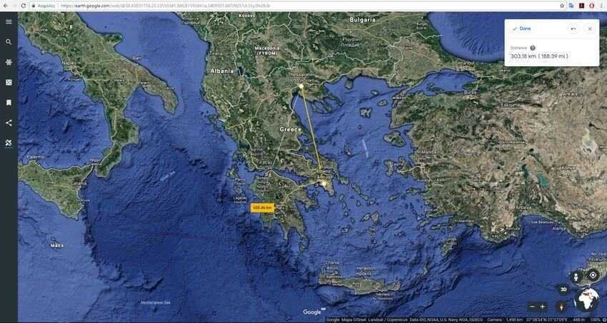
For example, as you will see in our test, you can specify the length of a straight path. In our example, as it seems, the distance between Athens and Thessaloniki is 303,18 kilometers, and if someone decides to change his mind and go down from Thessaloniki to Ancient Olympia again, he will have to travel 655.46 kilometers.
You can also use the tool to calculate the square footage of an area. To do this, just close the perimeter of an area and Google Earth will automatically calculate its perimeter and area.
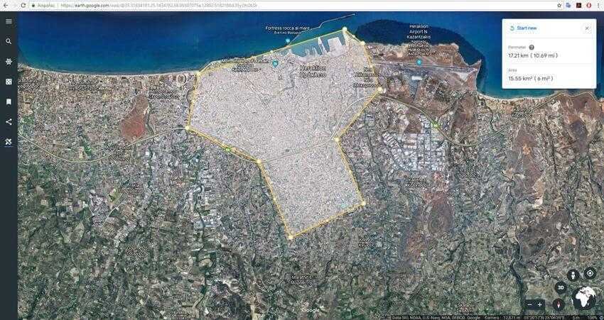
The tool may not have the accuracy of topographic plan but it is ideal for sampling measurements of fields, plots, etc. Relevant instructions can be read from Google help here.
