
With the help of a GRP radar archaeologists have completely mapped a buried ancient Roman city. They have found a monument, a market, a temple, a bath complex and water pipes.
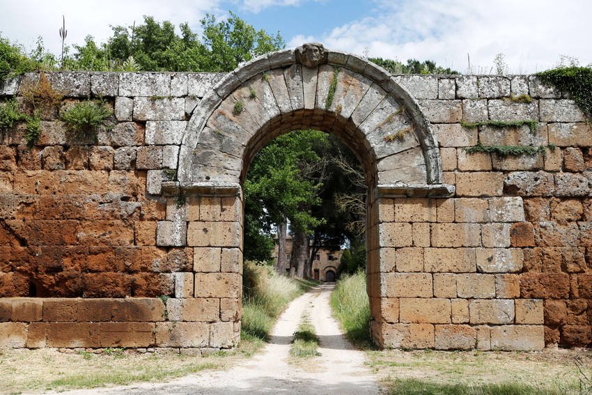
The Falerii It was once a walled city, north of Rome. It was probably founded around 241 BC. as the site of the relocation of the Falisci tribe who had rebelled against the Romans. It is located on a volcanic plateau and there were probably about 2.500 inhabitants during the third and fourth centuries BC.
The ruins are buried deep, but a team of archaeologists from the University of Cambridge and Ghent University in Belgium have used a ground-penetrating radar (GPR) to map the entire city. They described their findings in Antiquity magazine.
The first patent for a radar system for locating buried objects was filed in 1910. GPR (Ground-penetrating radar) used to measure the depth of glaciers, to study groundwater and groundwater, and to locate active landmines, buried sewers, and other applications.
The mission Apollo 17 of 1972 which was NASA's last Apollo moon landing mission, used a GPR system called Apollo Lunar Sounder Experiment (ALSE) to record depth information of the lunar surface.
GRP and the method it uses has found a new form of utility in recent years as a powerful tool for archaeological geophysics, as it is a non-invasive means of detecting and mapping objects, features and basic patterns below the Earth's surface.
GPR uses radio waves and differs from another popular method, the TO DEAL, which is based on infrared light from laser. An electromagnetic pulse is directed into the ground and any objects or layers (stratigraphy) can be detected by the reflections received by a receiver, just as in normal radar. The time it takes for the echo to return indicates depth and also different materials reflect incoming waves differently. The data can then be plotted to create detailed maps of these underground features.
Falerii Novi was first excavated in the 1990s and over the following decades archaeologists have located warehouses, shops, markets, a theater and a forum using a variety of non-invasive techniques, including magnetometry, a method that measures direction, strength. or relative change of one magnetic field at a given location to reveal details below the surface. However, the use of GPR by the British and Belgian teams gave a much more detailed and complete picture of the area, allowing them to study how the city has evolved over hundreds of years.
The authors adapted their GPR system to the back of one ATV, in order to more effectively examine the approximately 75 acres within the walls of the ancient city, taking a reading every 12,5 cm. In 2017, using their method, the team found the ruins of a large Roman temple, several meters below the city, which would be about the same size as St. Paul's Cathedral in Rome.
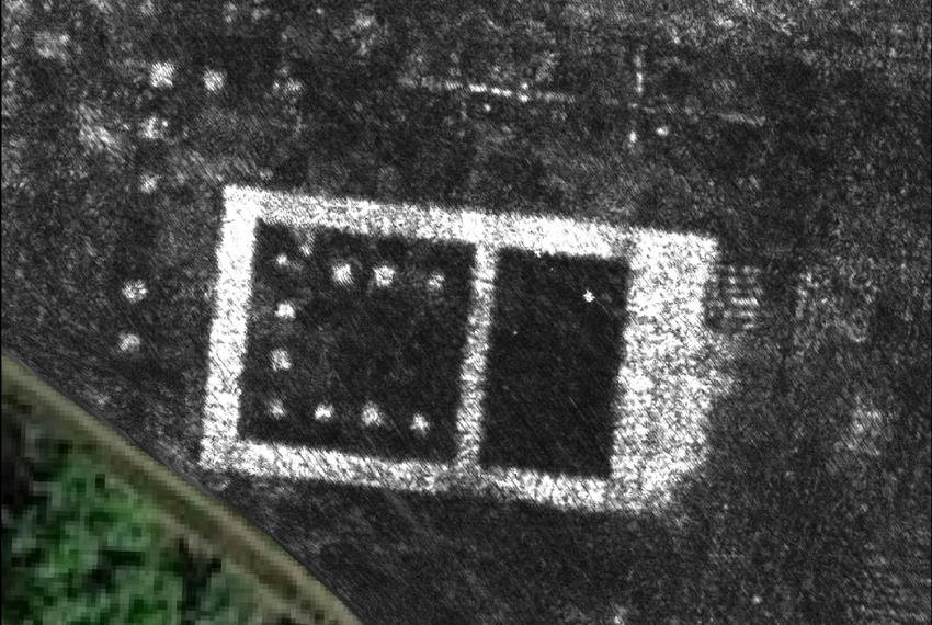
This latest analysis revealed a large rectangular structure connected to a network of water pipes, leading to the city's aqueduct. The authors assume that they are the ruins of an outdoor swimming pool (natatio), part of a large complex of public baths. To their surprise, they saw two large structures facing each other in a covered passage (porticus duplex) that they believe was once part of a large public monument near the north gate of the city. It seems to be part of a "sacred topography" of temples around the outskirts of the city, which had previously been revealed by magnetometer surveys.
GPR works very well in some conditions, such as even sandy soils, but the high electrical conductivity of clay and salts, for example, can significantly reduce signal strength. And in rock sediments the signal is scattered, making it more difficult to understand the patterns with so much noise. Archaeologists say that in Falerii Novi, the general dry conditions during the summer months were suitable for GPR research, noting, however, that when it rained, it took up to seven days for the soil to dry well enough.
Falerii Novi was a good location to show off the potential of GPR because it is not buried under modern buildings, unlike other ancient cities. GPR, especially when combined with magnetometry, is a useful tool for studying such cities. For example, the city theater displayed on magnetic data, and subsequent research with GPR, which provides a much clearer picture, measuring at different depths, giving an idea of the structural form of the theater, as well as evidence of abuse due to detachment of pieces of stone.
The biggest challenge in the future is the huge amount of data generated by this high resolution mapping. According to archaeologists, they have collected 71,7 million readings from Falerii Novi, corresponding to 28,68 billion data points or about 4,5 GB of raw data per 2,50 acres. It can take up to 10 hours to document an acre, so the team is developing automated techniques to speed up the computer-aided detection process.
"The astonishing level of detail we have achieved at Falerii Novi, and the astonishing features revealed by GPR, suggest that this type of research could transform the way archaeologists explore urban areas as a whole." said author Martin Millett at his University Cambridge.
He also added that it should be possible to use GPR to research large ancient cities such as Miletus in Turkey or Nikopolis in Greece. "We still have a lot to learn about Roman urban life, and this technology opens up an unprecedented opportunity for decades to come."
