
Google has announced that it will develop additional features in the Google Maps service designed to help travelers stay up to date with the latest COVID-19 incidents and occupant occupancy on public transportation
With the updated version adding the COVID feature of Google Maps on Android and iOS, travelers will be able to see the incidents that exist in a region, along with links to COVID-19 resources from local authorities.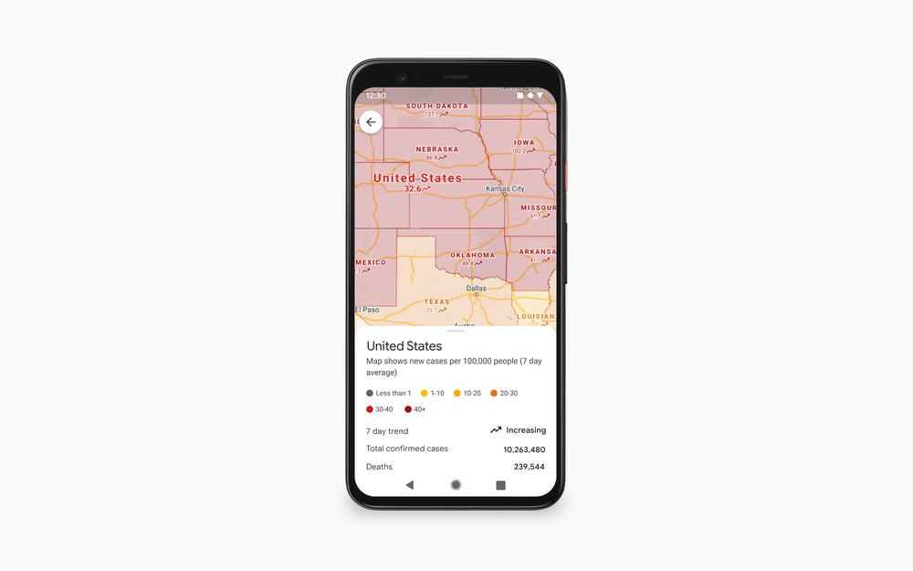
"This is especially convenient if you are out of town and need to be informed of local directions, test sites and restrictions," said Google Maps VP Dane Glasgow in a statement. Publication.
The COVID update on Google Maps will also include real-time MMM capacity details so passengers traveling by bus, train or subway can know if there is room to keep a physical distance from others while traveling.
According to Glasgow, the new feature, which will be available globally on Android and iOS devices, will be based on feedback from users of Google Map in real time.
This feature appears to be based on characteristics που εισήχθησαν τον Ιούνιο και ενημέρωσαν τους ταξιδιώτες για το εάν το ταξίδι τους θα επηρεαστεί από τυχόν περιορισμούς λόγω COVID-19, όπως η απαίτηση να φορούν μάσκα στις δημόσιες συγκοινωνίες, καθώς το πλήθος world that exists at a station at a particular time.
