
See in real time the locations of the Starlink satellites of the company SpaceX through an online map of the Earth.
At this link you can to see an interactive map of the Earth with all the satellites of the company SpaceX and their positions, in real time. You can click on any satellite and see more details about it. You can also see her movement their.
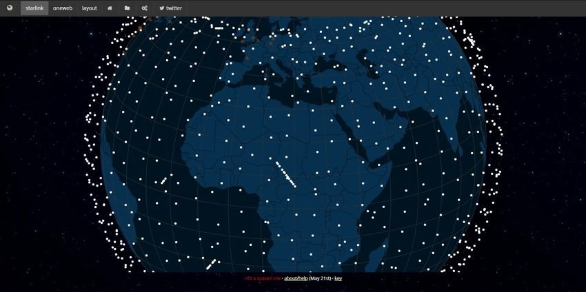
Although the website satellitemap.space is not affiliated with SpaceX, however it provides you with real-time StarLink satellite system data. All you have to do is go to the main website and then start browsing the map in any way you want. The map supports zoom and pan functions and you can rotate the globe in 360 positions to track or analyze the Starlink satellites.
The site is completely free and not even required enrollment. You can see which Starlink satellites are currently passing by your current location. Roll your mouse wheel to zoom in on a location, then click a dot representing the Starlink satellite. After that, it will show you all the details about him. You can see its name, start name, norad, attitude, level, status, activity and correction. You can see all the details for each satellite you see on the map.
Not only that, but you can also view the altitude history of any satellite graphically. Click on any satellite and the altitude chart history will appear on the bottom right.
Additionally there are some other options on the map that you can use, such as SpaceX's fixed stations on Earth (the ones with signal like WiFi). One of them is interesting two terrestrial stations in Germany where it is stated that it is not mentioned in the official records of the company and that it was "discovered" by a fan of the genre.
There are about 1500 Starlink satellites in the sky and if you are into astronomy and things like that then you will find this map useful. Just open it, watch and watch any Starlink satellite anywhere in the world.
