
Google has deactivated the data of the release of its Maps in Ukraine, in order, as it states, to protect Ukrainian citizens.
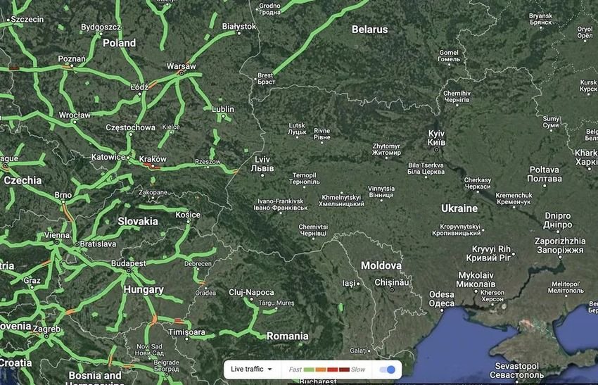
Google has temporarily stopped showing online traffic movement in Ukraine, offered by Google Maps. The reason is to protect the citizens as the country is being invaded by neighboring Russia.
The Google Maps traffic feature uses anonymous user location data, collected from Android smartphones, to indicate where traffic delays are and which businesses and stores are busy. Experts say such data could provide an insight into the progress of the invasion. But they could betray civilian positions, as well as their mass movements.
According to Reuters, Google decided to disable these features, to protect the security of local users, after consulting with the Ukrainian authorities.
The features have indeed been disabled from global access, but Google says online traffic information will still be available to drivers using navigation features in the area. It's unclear if Google has ever disabled these features in the past duration previous conflicts or wars.
The location data collected by services mapping tools often offer this kind of unexpected information. For example, when the Strava tracking application released a map in 2017 with user joking activity, accidentally revealed the location of several US military bases, showing where soldiers were running around airports.
Typically, this data must be combined with other sources to provide reliable information. In the case of the traffic jam outside Ukraine last Thursday, for example, investigators were already scanning the area using satellite pictures. The data itself may possibly come from civilians stopping at roadblocks, rather than soldiers using Android phones.
However, the only sure thing is that technology is now deeply rooted in our lives. And not a few users are trying to figure out what's going on in the area from Flightradar24, or marine traffic, or filtering news and videos on Twitter, Tiktok etc, putting hashtag #Ukraine.
