
Η Google ανακοίνωσε ότι θα αναπτύξει πρόσθετες λειτουργίες στην υπηρεσία Google Maps που έχουν σχεδιαστεί για να βοηθήσουν τους ταξιδιώτες να ενημερώνονται με τα τελευταία περιστατικά COVID-19 and occupant occupancy permitted on public transport
With the updated version with its addition modeWith Google Maps' COVID-19 update on Android and iOS, travelers will be able to see what's happening in an area, along with links to COVID-XNUMX resources from local authorities.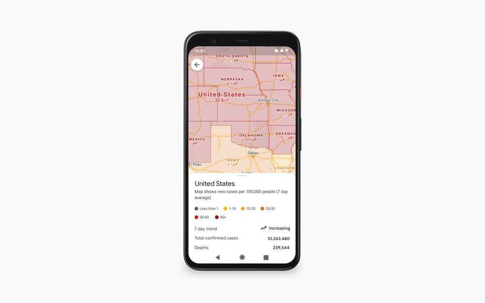
“This is especially convenient if you're going except of your city and should familiarize yourself with the local guidelines, test locations and restrictions that apply," says Google Maps VP Dane Glasgow in a Publication.
The COVID update on Google Maps will also include real-time MMM capacity details so passengers traveling by bus, train or subway can know if there is room to keep a physical distance from others while traveling.
According to Glasgow, the new feature, which will be available globally on Android and iOS devices, will be based on comments that Google Map users are doing in real time.
This feature seems to be based on features introduced in June and informing travelers about whether their trip will be affected by any restrictions due to COVID-19, such as the requirement to wear a mask on public transport, as well as the crowds that exist in a station at a specific time.
