
Google has announced that it will develop additional features in the service Google Maps designed to help travelers keep abreast of the latest developments COVID-19 and occupant occupancy permitted on public transport
With the updated version with its addition modeς COVID του Google Maps σε Android και iOS, οι ταξιδιώτες θα μπορούν να βλέπουν τα περιστατικά που υπάρχουν σε μια region, along with links to COVID-19 resources from local authorities.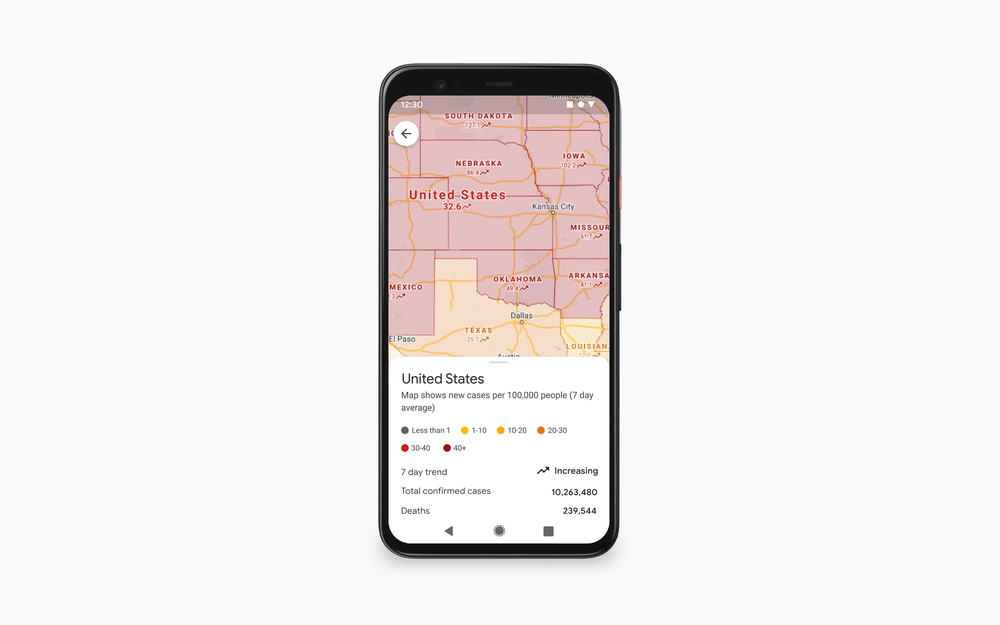
"Αυτό είναι ιδιαίτερα βολικό αν πηγαίνετε εκτός της πόλης σας και πρέπει να ενημερωθείτε με τις τοπικές οδηγίες, τους χώρους εξετάσεων και τους περιορισμούς που ισχύουν", αναφέρει ο VP του Google Maps, Dane Glasgow σε μια Publication.
The updated version with COVID indicators on Google Maps will also include real-time capacity details at public transport, so passengers traveling by bus, train or metro will know if there is space to maintain physical distance from others while traveling.
According to Glasgow, the new feature, which will be available worldwide on Android and iOS devices, will be based on comments made by Google Map users in real time.
This feature seems to be based on features introduced in June and informing travelers about whether their trip will be affected by any restrictions due to COVID-19, such as the requirement to wear a mask on public transport, as well as the crowds that exist in a station at a specific time.
