
Google introduced a series of new possibilities of Google Maps that aim to help users travel safely by car or public transit as countries begin to reopen after the lockdown caused by the COVID-19 pandemic.
With the latter version of Google Maps in Android και iOS, οι χρήστες της εφαρμογής θα μπορούν να λαμβάνουν ειδοποιήσεις σχετικά με το εάν τα ταξίδια τους θα επηρεαστούν από τυχόν περιορισμούς λόγω COVID-19, όπως η απαίτηση να φορούν μάσκα στις δημόσιες συγκοινωνίες ή εάν υπάρχουν κάποια σημεία ελέγχου ή περιορισμοί κατά τη διαδρομή της οδήγησης.
"The transition from A to B can be very complicated these days. "Because of COVID-19, it is increasingly important to know how many people may be at a train station at a given time or if the buses are running on limited routes," Ramesh Nagarajan told blog of the company.
"Having this information before and during your trip is vital for employees to go to work safely and will become much more important to everyone as countries around the world begin to reopen."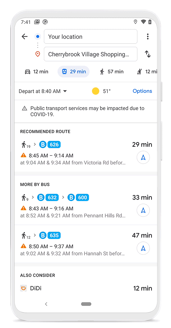
Users in COVID-19 medical facilities or testing centers will also receive alerts that remind them of the facility's safety instructions and will be able to verify the possibility of testing to avoid rejection, Google says.
In addition, the company said that to help users avoid busy public transportation, users will be able to see rush hours when a station is historically more or less busy. Users will have access to live data that shows how busy a station is compared to normal levels.
The data will be aggregated and anonymous according to the company and will be used by local and state governments or by websites to feed the new features.
The notices will initially be released in Australia, the United Kingdom, the United States, Argentina, Belgium, Brazil, Colombia, France, India, Mexico, the Netherlands, Spain and Thailand.
