
Google brings one new update in Google Maps which adds more color for a better view of the terrain.
The function is based on its current color coding applicationς και εισάγει περισσότερη λεπτομέρεια στο είδος του εδάφους. Τα χρώματα επιτρέπουν στους χρήστες να διακρίνουν μέρη όπως “παραλίες ή έρημοι, μπλε λίμνες, ποτάμια, ωκεανούς και χαράδρες”. Οι αλλαγές μπορούν επίσης να εντοπίσουν το χιόνι στα βουνά και την πυκνότητα του πρασίνου στο χάρτη.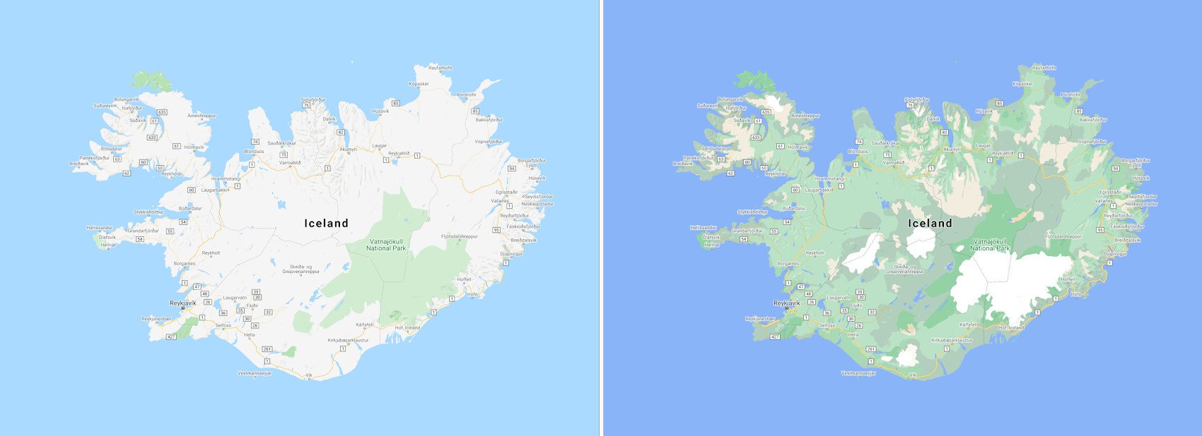
Η company says the feature helps users explore an area in detail and meaningfully before planning a visit.
As for how the app differentiates landscapes, Google says it combines computer vision and satellite data for soil analysis. It then assigns an HSV model (hue, saturation, hue value, saturation, value) to a denser soil code - such as forests - with a darker shade and so on.
While these visual changes are circulating to all Map users around the world, the company is preparing to bring another feature that improves road information for walking.
The analytical projection it will help users locate exactly where "sidewalks, crossings, etc." are by marking them appropriately, which the company says will help users with disabilities. The changes will also bring precise road shapes and widths.
Detailed street maps will be released in the coming months for users in London New York and San Francisco. Google plans to expand the features to more cities in the future.
Finally, Google reports that Maps Platform developers will soon be able to integrate visual color changes into their maps.
Other improvements announced recently in the app, adding traffic lights and bike parking information improves usability not only for vehicle navigation, but also for other modes of transportation.
