
The Last satellite monitoringThe European Space Agency's weather probe, Meteosat Third Generation Imager-1 (MTG-I1), has sent back its first image from Earth.
The satellite was launched into geostationary orbit 22.000 miles above Earth's equator in December 2022 using an Ariane 5 rocket.
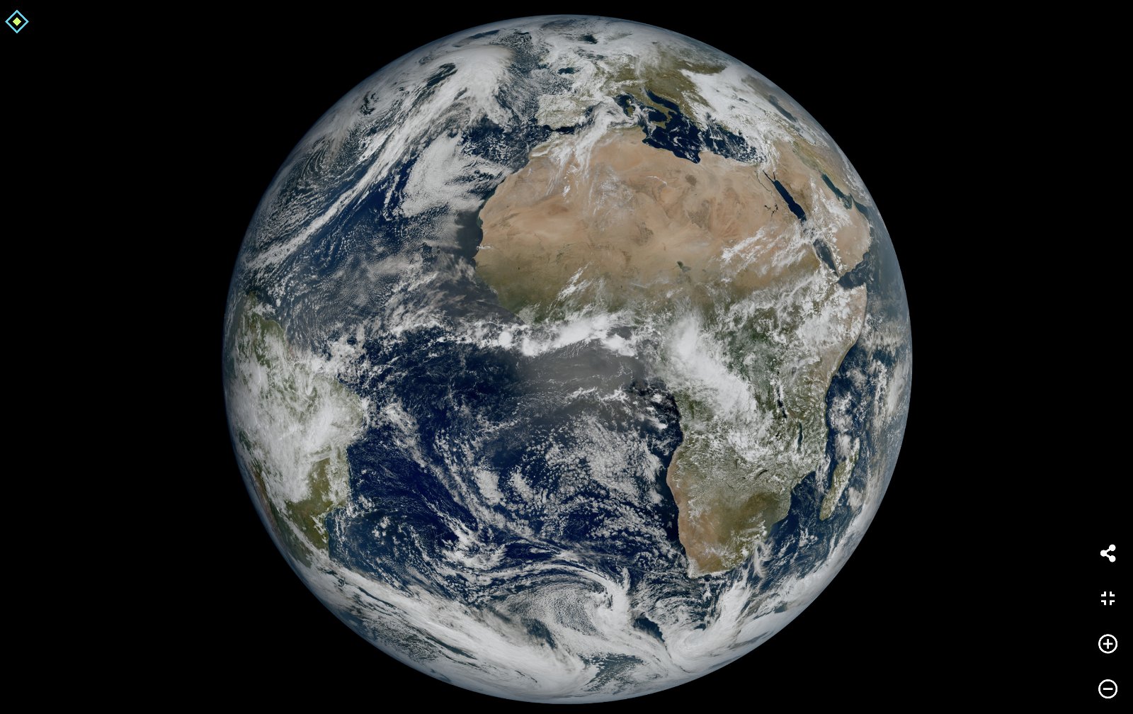
It is designed to monitor the weather conditions in the regions of Europe and Africa. It captured the first view of Earth on March 18, 2023, using the onboard Flexible Combined Imager. The image shows much of northern and western Europe as well as Scandinavia covered in cloud, while skies are relatively clear over the western Balkans and Italy.
It shows great detail of cloud structures at high latitudes in the Nordic region. It also shows more details such as snow cover in the Alps, sediment in the water along the coast of Italy and cloud eddies over the Canary Islands.
The level of detail revealed by the image was "impossible to capture over Europe and Africa from a geostationary orbit until now" and "will give us a better understanding of our planet and the weather systems that shape it", according with Simonetta Cheli, Director of ESA's Earth observation programmes.
The agency says the satellite's instruments can produce pictures with much higher resolution than the second generation Meteosat satellites.
ESA reports that the MTG satellite is currently in the commissioning phase where its data is being collected and calibrated. The data will be distributed to weather services in Europe and other regions by the end of this year and will soon reach weather apps.
You can download the incredible original quality version of the image from here (68,91MB).
