OroraTech: The first space image from Greece for fire detection

Η OroraTech, a global leader in space-based fire detection solutions, announces the successful activation of the Hellenic Fire Extinguishing System (Hellenic Fire System). Less than a month after launch, the satellite sent the first thermal image over Greek airspace, confirming the operational readiness of the system and laying the foundation for a new era in forest fire monitoring and management in Greece.ororatech
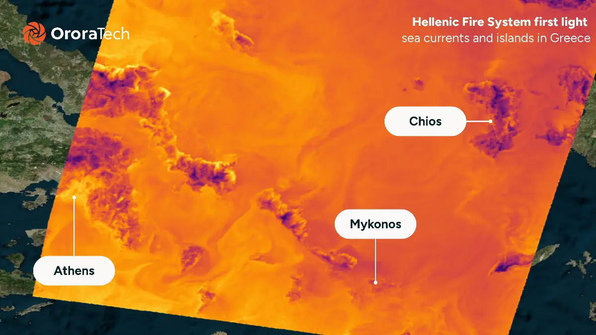
After two weeks of demanding calibration tests, OroraTech’s thermal technology has proven its readiness in practice. The “space eye” recorded in absolute detail the thermal footprint of the Athens basin and six Aegean islands (Andros, Tinos, Skyros, Chios, Kea and Kythnos ). Also impressive is the fact that the system managed to identify thermal patterns created by the turbulent air flows over the Aegean, confirming the high level of technological superiority of the mission.


See more articles from iGuRu.gr when you search for news on Google.

This achievement confirms the effectiveness of OroraTech and the superiority of its thermal detection systems. The sensors are designed to provide extremely accurate measurements of ground surface temperature, forest fire detection capabilities and broader terrestrial and marine thermal phenomena operating from Low Earth Orbit (LEO), with low latency in data transmission and high revisit frequency of observation areas.

“ Achieving the first data acquisition so quickly demonstrates the maturity of our technology and the outstanding work of our engineers ,” said Martin Langer , CEO of OroraTech . “ We have dedicated years to improving thermal detection systems, which offer both unparalleled image quality and top-notch operational performance. This milestone demonstrates our ability to quickly deploy advanced space systems while providing high-quality thermal data needed for forest fire detection, environmental monitoring and scientific research. ”

The Hellenic Firefighting System is being developed as part of Greece’s national investment in enhancing forest fire resilience through space technologies. When fully operational, the satellite constellation will scan the entire country of Greece twice a day, providing continuous thermal monitoring to support forest fire detection, emergency response and climate research activities. The system will also produce valuable land surface temperature data for scientists and researchers studying environmental change in the Mediterranean region.


Google preferences

Leave a Comment

Your email address will not be published. Required fields are marked *

Your message will not be published if:
1. Contains insulting, defamatory, racist, offensive or inappropriate comments.
2. Causes harm to minors.
3. It interferes with the privacy and individual and social rights of other users.
4. Advertises products or services or websites.
5. Contains personal information (address, phone, etc.).