
A new service from Google, integrated into the Google Maps application comes to make our lives easier. The application began to feature information for real-time public transport in San Francisco, Chicago, Seattle, Budapest, the Netherlands and the UK, for starters.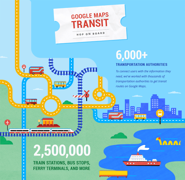
So the Google Maps app will show information about MMMs, such as a bus, or if the train is late,
To achieve this, Google works with over 6.000 Companies and transport organizations.
So, shortly in Company Maps, there will be choices for public transport and will appear when you plan a route.
If in line of the subway you want to take exists delay Maps will give you an alternative route to arrive on time.
Google reports that the new feature serves today over 18.000 cities in 64 countries and has over 2.500.000 railway stations, bus stops and ferry terminals.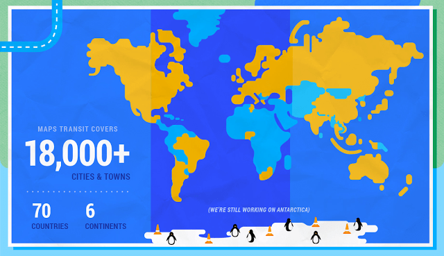
You can read more information from the announcement publication the new service.
