
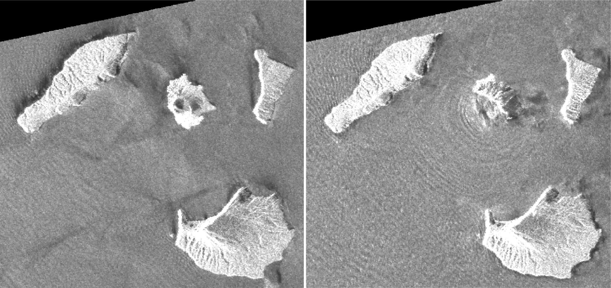
The entire southwest side of Indonesia's Anak Krakatau volcano appears to be missing, as new pictures from a satellite radar. The volcano's eruption triggered massive landslides on December 22, creating a tsunami that killed over 420 people.
The images come from the JAXA ALOS-2 satellite and then analyzed by the Japanese Geoinformatics Authority, according to Associated Press.
Regular satellites photos of the volcano were not possible due to the continuous covering of dust clouds in region. The first image was taken two days before the eruption on August 20, 2018, and the second two days later on December 24, 2018.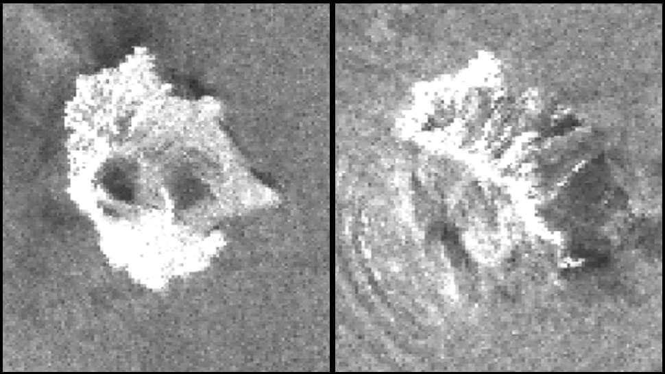
Looking at the photographs, it seems that the entire southwestern part of Anak Krakatau disappeared, probably from a flood-like landslide caused by the continuous eruptions. The following tsunami erupted along beaches along Indonesia's Sunda Strait, killing hundreds.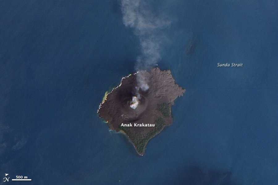
As the pictures show, Krakatau is much smaller than before landslide. The concentric circles are the waves that are removed from the island of Anak Krakatau.
Anak Krakatau began to show signs of intense activity in July, but in the past two weeks it was particularly active.
For history, 1883 has been another major explosion, sending waves across the planet, not one but four times in a row. The explosion affected the global climate and caused temperature drops around the world.
_________________
- Take your photos with GoPro's Quik
- Google: Delisted Duck.com to DuckDuckGo
- Download free high resolution satellite images (HD)
